
Practical Examples of GIS-Remote Sensing Technology in Earth Sciences
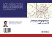
Focused on seismically active country, Iran
LAP Lambert Academic Publishing
€71.90
(inklusive MwSt.)
Verfügbarkeit: Titel wird für Sie produziert, Festbezug, bitte vormerken
Zusatztext
The mapping was started from an ancient era and even now it is developing rapidly which deals with spatial information like the Where question. From the Neanderthal to the Human, all were asking same questions like Where is my cave!? or Where is the starting point?. These sorts of questions show that how much the mapping and the locations are important and can be helpful. René Descartés invented 2D coordinate system and then mapping of the world and some phenomena (e.g. earthquakes) were much easier. Now Geospatial Information System is a sophisticated type of 2D coordinates. This book presents multi-disciplinary examples among GIS, seismology and earthquake engineering by emphasizes on remote sensing and coordinates.
Autorenportrait
Dr. Sadra Karimzadeh has obtained his Ph.D. degree from Kanazawa University, Japan. His primary area of expertise is remote sensing-GIS data fusion, and he has worked on applications for observing surface deformation, civil engineering, and theoretical aspects of boosting accuracy of seismic networks.
Weitere Details
Erschienen: 07.09.2015
Umfang: 176 S.
Sprache: ENG
Einband: KT
Format: 1.1 x 22 x 15 cm
ISBN/EAN: 9783659771316
Umbreit-Nr.: 8616413
